Friday, December 30, 2016

2016-07-16 Fishing with Tyler

For this trip I had my grandson Tyler along as crew.

We pulled out around 8:30 AM and immediately went over to the fuel dock to take on 120 gallons of fuel.

By 11 AM we were trolling in the Clover Pass area.
Seas were a little rocky, but not bad, still fishable.

By 12:30 PM we had 1 Pink in the cooler.
It was an exciting catch because of the net.
Tyler had the rod and I netted the fish.
After I netted the fish I saw it free swimming again.
It took a few seconds for my brain to register what had just happened.
Then I realized there was a hole in the net.
The webbing on these nets eventually deteriorates.
Fortunately we were able to wrap up the fish again and get it in the boat.

I used some cotton twine that I keep on board to make temporary repairs to the net.
Then when we got back to town I bought a new net.
I keep both on board during the salmon trolling season because once the Silvers come in, it is not unusual to have two or more fish on at one time.

By the time we pulled the gear at 4:30 PM we had 2 more Pinks in the cooler.

We were back in the stall by about 6 PM.


We saw a whale go past the boat while we were trolling.


Tyler shows off the catch of the day.

2016-07-11 Fishing with Dr Paul

One of the neat things about doing a trip like we did when we brought the boat back up from Seattle is that you meet people.  And the people you meet many times are people like you.  They enjoy the boating life style.

You can make new friends.

One of the new friends I made was retired doctor Paul Switlyk.
He was running along with the Waggoner Flotilla, and we were able to spend some time talking about boating and other things.
During those conversations it came up that he really wanted to do some salmon fishing.
So we developed a plan that when he came back through Ketchikan on his run back south we would link up and I would take him salmon fishing.

So that's what we did.

I had my grandson Bryan along for this trip as well.

We pulled out about 8:30 AM and went out towards Vallenor Point.

Got the trolling gear in the water and by noon we had 3 nice bright Pinks in the cooler.
We lost several as well.

Around noon we moved over to the Survey Point area and started trolling again.

It was a slow afternoon, yielding only 1 more Pink.

Back in the stall around 5 PM.

I can't believe I never took any pictures of special guest Paul.


This beautiful cruiser passed by us as we were trolling near Vallenor Point.
I am always interested in boats.
Sometimes I can look them up via Google and find out their background and history.
Not so on this one, though.


Bryan shows off our meager catch of the day.
This early in the season the Silvers aren't in yet, so we usually get Pinks.
Pinks are fine as long as they are bright and firm.
A little later in the season they may be a little slimy, and those we kick back in.


Bryan is pretty happy showing off this fish.

Sunday, November 6, 2016

2016-07-03 Naha Trip

If you have read many of my previous posts you will know that the Naha is one of my favorite places to visit.  You may also recall that about 3 years ago we had a tremendous wind storm in the early fall,, and as a result of that the ramp from shore to the dock was damaged.  The USFS (US Forest Service) eventually took it out.

So after that the dock was still there, but since it had no ramp to shore it was essentially no longer a "dock" per se, but was now a "float."

In any case for this 4th of July trip it was just myself, First Mate Lisa, and First Dog Bina.

Here is a Google Earth shot of the Naha Bay area.


In the upper portion you can see the notation for the community of Loring.
There are about a dozen or so buildings, and a state dock there.

In the lower right portion you can see the USFS float highlighted in a red oval.
It is very protected in there and the trail (not visible in this shot) starts right there and goes up into the woods and along Roosevelt Lagoon, eventually along the Naha River.

We left town at about 10:45 AM in rainy, overcast, but calm conditions.

Around noon we shut down in the Clover Pass area and had lunch and prepared the shrimp pots.
We eventually dropped the shrimp pots in Clover Pass at a spot I have marked as a waypoint in my GPS.

We arrived at the Naha float at about 2:30 PM, and no one else was there.
Later in the afternoon another boat came in, about a 26 footer, with a young man and woman on board.  Looked like they had been salmon fishing.

Evidence of the devastation from the storm is still plentiful.
Trees are down and are in quite a jumble right above the float.

We took a shore excursion in the raft and stretched our legs.


This is the covered picnic area that is just up the trail from the float.
Over the years we have had many family picnics there.
There is a picnic table and a fire pit under the cover.
I have been on trips here in the past where I have seen younger people bring tents and set them up under the cover and have a little camp out right there.
It's a nice place to hang out.

After dinner I saw a small group of people come down the trail right to the edge of the water and hail the people on the smaller boat that had come in.  The people said they were from a larger vessel that was anchored up near Loring, but their raft had gotten stuck behind a big log and they were stranded, at least until high tide moved the log.  They wanted a ride off the beach and back to their vessel.  Our raft was already in the water so I ferried them from shore to the float, and the people in the other boat ran them back out to their anchored vessel.  Did not get any pictures, sorry.
We try to help others in need when out in the wilderness, for someday it could be us that need help.


Yet another beautiful Naha sunset.


The rapids churn up lots of foam, which then flows out into Naha Bay.
Unfortunately if it builds up around the hull of the boat it will discolor it, and it is difficult to get off.
It does look pretty neat as it parades by, driven by the strong current coming out of the rapids.


This is where the ramp to shore is supposed to be.
You can see the damaged bull rail just to the left of the base for the ramp.
A huge tree landed there, large enough to break a bull rail that is about 12" x 12".


Faraway sits at the float, with evidence of the storm damage on the hill just above.


The float at the Naha is in need of some TLC.
It has some holes in it, and the boards are deteriorating badly.
It is very slippery in spots, with grass and molds growing rampant.
I hope the USFS can allocate some funding to give it some attention soon.


A better view of the jumble of trees that were blown down during the storm.
Glad I wasn't here then!


Since there is no ramp, if you want to get to shore you have to have a raft or some other way to get there.  This young family came in and took a canoe to get to shore.  Another family out enjoying the remote wilderness experiences that our area has to offer.


Here are a couple of views of the private lodge that sits on about 60 acres, right near the village of Loring.  It was built several years ago by a man from Oregon.  He used it as a private getaway lodge for awhile, and then leased it out for a time.  Then he got into a divorce situation and the lodge was on the chopping block.  I don't know who ended up getting it.

Most of the times when I come by it is clearly empty.  But this time there was a boat at the dock and evidence of people there, so I guess one can assume it is once again in use.


This is the dock at Loring, which is owned and maintained by the State of Alaska.
Since it is state owned it is available to any vessel that wants to tie up there, on a first come, first served basis.

I have tied up there a few times when the Naha dock was full.
It is much more exposed to weather than the Naha dock and so if the weather gets nasty one can end up having a rocky time on board.
And of course once you go up the ramp you are in someone's front yard, so it is not exactly the same wilderness experience that one would have at the Naha.

On Monday morning we took another short shore excursion to de-water Bina, and we pulled away about 10:30 AM.

The weather was good so we trolled the Grant Island area for a couple of hours, but only got one strike.

We did have one interesting event however.
While we were trolling in calm waters an eagle soared in and splashed down into the water just a few yards from the boat.  He actually crash landed in the water!  Not sure if he was after a fish or exactly why he did that.  He turned into the light wind and immediately took off again.

We pulled the shrimp pots and got a load of about 66 shrimp.

We were in the stall by 5 PM, arriving in hot and sunny weather.


Wednesday, September 7, 2016

2016-06-17 Marguerite Bay with Tyler and Bryan

June 17 - 18

For this trip I had 2 of my grandsons, Tyler (age 11) and Bryan (age 9).

We left the harbor about 8:30 AM and headed for the fuel dock.
The boys are getting old enough now that they can actually help me with handling the boat, specifically getting into and out of docks.
So I had thoroughly and repeatedly briefed them on the process for coming into the fuel dock, specifically what their roles should be.
It threw them off a bit when the fuel dock attendant was there to help.
But we made it in to the dock OK.

As it turns out the NOAA (National Oceanographic Atmospheric Administration) vessel was moored right next to the fuel dock, and for some as yet unknown reason, they decided to put an absorbent boom around it.

Here is what I picked up off Google for a definition of an absorbent boom:

These booms are often referred to as sorbent booms, marine booms, marina booms, sea booms, ocean booms or oil spill booms. Oil absorbent booms are perfect for the control of and the clean up of oil spills on water. They can also be used to contain and absorb large industrial hydrocarbon spills on land.


The orange band at water line is the boom

In this photo the absorbent boom is around the NOAA vessel, however while they were deploying it they pulled it directly in front of the fuel dock, which is just astern of the NOAA vessel, thus preventing us from leaving.

Our departure from the fuel dock was delayed for a while, but we eventually were able to leave.

We made our way through Tongass Narrows and into Clover Pass and prepped and dropped the shrimp pots at my waypoint just in front of Salmon Falls Resort.

The kids were helpful in this effort as well.

We also prepped the crab pots there because I wanted to be able to drop them quickly as we approached the USFS dock at Marguerite Bay in Traitors Cove (Western Behm Canal).
I am always paranoid that we will get within sight of the dock and there will be only one spot left, and some other boat will slide into it while we are setting the pots.

Fortunately today, there were no other boats around, and we entered the bay, dropped the crab pots, and got tied up to the USFS dock at Marguerite Bay.
This is a spot we've visited numerous times.
We really enjoy spending time here.
To have it all to ourselves was a real bonus.


This trip was all about the kids having fun.

I had a BB gun for them to use, which they really enjoy.
I've told them it belongs to the boat.
They have to take turns with it since there is only one, which sometimes creates problems.


Tyler shows good shooting form.
We discovered later in the summer that it shoots much better with the scope off.

We also had sling shots, from Walmart.
They seem to be short term use sling shots because for whatever reason the rubber bands seem to start breaking after just a few hours of use.


Tyler shows good form with the sling shot, but Bryan's a little hunched over with the BB gun.

They also did a lot of dock fishing, something they never seem to tire of.


Maybe this will teach them patience.

Another thing that has become sort of a tradition with us is that once we reach our destination I issue them each their own Leatherman to use during the trip.  They don't have pocket knives of their own yet, so this is a big deal to them.  Of course I gave them some training on how to use them safely, and so far there have been no accidents.

Last Christmas Lisa gave me a metal fire pit that can be used on a wooden dock, so if we are lucky enough to get up to a dock as we were today, we can have a fire right there.

I had brought all the makings required for S'Mores, and they had fun cooking them.


They have to be cooked just right.
Don't let them catch fire.
A few do overs ended up in the bay.

I had also brought along a couple of kites.
Sometimes we fly them from a spinning rod while we are underway, but today we flew one from the dock.  You need a little wind to get them up there, but once they are up they fly pretty well.


Sometimes it's fun to just sit around and hang out on the dock.


Tyler relaxes on the dock.
He loves his iced tea.
He can make a bottle last an hour.

I cooked spaghetti and sauce right there on the dock on my Coleman Stove, and we had a real pleasant evening.

Just before dark we motored out in the raft and checked the crab pots.
They were empty but the bait was still good so we moved them a bit and reset them.

Sunset in Traitors Cove


Saturday morning we were up fairly early and I cooked pancakes on board.
That's always a big hit with the kids.

Then it was off for a hike up the road.
There is a logging road there that runs for many miles.
Since I don't have a 4 wheeler I have only explored part of the road system.
We walked up just a little way to stretch our legs a bit.

Foxglove

Bear "Sign" - fresh too

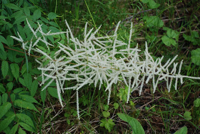
Unsure what these are, but they are beautiful

Some kind of lichen I assume
When we got back from the hike we checked the crab pots again and this time got 3 keepers.
Dungeness crabs, which is what we usually get around here, have to be males of a certain minimum size in order to be kept.
I set up my propane cooker on the dock and we cleaned them and cooked them.

Bryan enjoys fresh crab on the dock

The boys are just old enough that I now trust them to take the raft out for short excursions on their own.  My new electric kicker works well but doesn't really go fast enough for them to get into too much trouble.  I give them a hand held radio so we can stay in contact while they are out.

Bryan and Tyler take the raft out
We cleaned up all our gear and got ready for a 2:30 PM departure.

I have been having trouble with a small and slow coolant leak on the starboard engine, so I went down to the engine room to check that before we pulled out.  I added a little coolant to that engine.
After we had been away from the dock for about 10 minutes I started thinking, did I put that radiator cap back on?  Of course I did, but better check.
I had not, and I had been running the engines for a short time with the radiator cap off.
You can imagine the mess that made!
But at least the engine did not overheat before I corrected the situation.

On the way home we stopped and bottom fished just for an hour or so.
Tyler got 1 Sea Bass, but I neglected to get a picture of it.

We got into the stall about 8:45 PM.
Another successful adventure for Faraway.

Monday, September 5, 2016

2016-06-06 Fishing with the grand kids

June 6, 2016

I apologize for not keeping up with the blog posts after returning home from Seattle.

I'll try my best to get caught up as quickly as I can.

We've made no real long trips since returning home, but just a lot of short trips, many of them one day fishing trips.

On this trip we had two grand sons, Tyler (11) and Bryan (9), and their step Dad, Devon.

It was essentially a half day fishing trip, since we didn't pull out of the harbor until about 11 AM.

We went south of town, to the Mountain Point, Cynthia Island area, and just ran two rods, even though there were 4 of us.

We hit one fish only, a smallish Silver, at about 1 PM, and then nothing at all after that.
Tyler kept saying, "We're in the salmon capital of the world, and we can't catch a salmon."
Some days are like that.

Then they all fell asleep.
Wish I'd snapped a picture of that!

Back in the stall at about 6:45 PM.

Tyler, Bryan, and Devon


Saturday, August 13, 2016

Seattle to Ketchikan Day 27

Monday May 30

Well this is it - our last day underway.

It's about 95 nm from Prince Rupert to Bar Harbor.
Most normal people would break it into 2 parts and stop somewhere along the way, probably Foggy Bay.
But since we were both so eager to get home we decided to make it in one day, if at all possible.

The weather router had assured us that the open ocean crossing of Dixon Entrance would be smooth, and we had prepared ourselves for going out through the "short cut" through Venn Passage.

Here are two map snippets that show the route from Prince Rupert to Foggy Bay (about 60 nm) and then the route from Foggy Bay to Bar Harbor in Ketchikan (about 35 nm).  Of course we did it all in one long run.

Prince Rupert to Foggy Bay

Foggy Bay to Bar Harbor
We departed at 7 AM, running directly behind two other boats whose owners we had come to know during our 3 day layover in Prince Rupert.  I had shared our weather forecast with them.

One of the boats was named "Floating Island."
The owner lives in Butte Montana, but keeps the boat in covered storage in La Conner Washington.
The boat is a 1978 48' Tollycraft.

The other boat was a 32' Bayliner called "For Pete's Sake."

I was right behind them as we went through Venn Passage.
My Garmin GPS/depth finder was on the blink for most of the passage so I really had no idea of the actual depth.
But since I was right behind the other boats I had no issues.

Our weather router earned his money on this run, as it turned out to be the smoothest crossing I've ever had.  Lisa didn't even get seasick, and that's saying a lot.

About 12:30 PM we were inside US waters, near Mary Island, when our friendly US Coast Guard decided to pay us a visit, for a safety check.  They check for things like life jackets, flares, documentation, fire extinguishers, placards, etc.

They came aboard and after checking everything gave us what they call a "Good as Gold" boarding report.  If we are approached any time within the next year for another safety check we can show this boarding report and they will pass us by.  Even though it was frustrating to have to stop and be delayed so close to our goal, it is good to get this out of the way now, so it won't be an issue for at least another year.


This time I managed to snap a quick picture as they motored away.
You can see how flat the water is - terrific!

As we approached Mountain Point, barely a few miles from Bar Harbor, we saw some Orca, Killer Whales  Figures, we had not seen any on the entire trip, and now we see them less than 5 miles from home.  Sorry the pictures aren't better, it's the best I could do.


We pulled into our home slip in Bar Harbor at about 4 PM local time.
I called the US Customs office and an agent came down and processed us in record time.
Said he had to get over to the airport.


We logged about 800 nautical miles, and put 112 hours on the engines.

We were glad to be home.

Thursday, August 4, 2016

Seattle to Ketchikan Day 24

Today's destination was to be Prince Rupert, about 58 nm distant.
It is the jumping off point to US waters, and home.

Here is the route for the day:


Here is a map snippet that shows more detail of the approaches to Prince Rupert:


After a brief shore excursion for Bina we pulled anchor at about 8:15 AM.
It was rainy and cold, just like home.

As soon as we got out into Grenville Channel we hit strong opposing currents.
This is always frustrating under any conditions, but seemed to hurt a bit more today as we were approaching Prince Rupert, and we had almost 60 nm to go.

I was also a little more cognizant of the fuel level on this run because I had deliberately not gotten fuel in Hartley Bay.  Last year some local residents were very rude to us and I really didn't want to stop there again this year.

At one point the engines were turning 2200 RPM and we were making barely 5.6 knots.
Under normal conditions I would expect to be running about 10 - 11 knots at that RPM.

The farther along we got the less impact the current had, so the situation got better as the tide turned.
At one point I called a tug and barge that was ahead of us and asked him if he knew when the adverse currents would abate.  He said he wasn't even paying attention to it.  I guess when you run a tug and barge all day and all night in all kinds of conditions you get used to just taking whatever comes.

By 1 PM we were making 11 knots at 2200 RPM, just where we should be.

We got into Prince Rupert about 3:30 PM and immediately went to the fuel dock.
We had to wait awhile for room at the dock but eventually got in there and fueled up for the final run to Ketchikan.

After getting fuel I called the PRRYC (Prince Rupert Rowing and Yacht Club) harbor attendant and got my slip assignment. 
We pulled away from the fuel dock and headed towards the assigned slip.

Now, I want to make it clear that in this next narrative I am not trying to place blame on the harbor attendant, since the person piloting a boat always takes responsibility for where it goes.  But I do think that her actions contributed in some way to the events that occurred.

While on the way to our assigned slip she suddenly came over the radio and started yelling directions to go to a different slip.  I quickly changed course to head for the new slip, and just then the wind picked up and started gusting.  As we rounded a corner we clipped the anchor of a sailboat that was backed into the corner slip.   This is the first time I have ever hit another boat while maneuvering within a harbor.

Lisa was down below, ready to get the lines, and she heard the hit on the other side but did not see it.
She yelled out "What was that?"
I said, "We hit another boat!"

After we got safely tied into our slip, two men from the sail boat came over and we started inspecting their boat.  This process took a long time.  They said that once before they had gotten hit and had prematurely and inaccurately told the owners of the other boat that there was no damage.  And they had discovered damage later on.  So this time they wanted to be certain.

Eventually they decided that I had bent a railing on their anchor pulpit.
So we measured the distance off the water of the minor bend in their railing and then went over to my boat to see if it would match up with any damage there.
It was immediately clear that nothing on my boat matched up with that bend in their railing, so they reluctantly (it seemed to me) agreed that there was no damage to their boat.

On our boat there was a small crease in a vertical railing, and that was it.

Here is the sail boat whose anchor we clipped:


And here is the minor damage on our boat:


Big freighter passes by the yacht club


Faraway in her slip at the yacht club


A handy lunch table


Prince Rupert Rowing and Yacht Club

This is the "old" yacht club building.
They told me that after this cruising season they are tearing it down in order to build a new one.

The yacht club is within easy walking distance of the downtown area, so it was pretty easy to walk into town and get groceries, and stretch our legs in the process.

In order to get back to Alaska we needed to make one more open ocean crossing, Dixon Entrance.
On the advice of our weather router we sat here in Prince Rupert for 3 nights.
Unfortunately there was an issue with the shore power on the floats and we lost power after the first day.  After that we had to run the generator from time to time, and rely on the new inverter.
They didn't offer to refund any of the fees we paid for moorage.

One of the things we did while waiting for our weather window was to study Venn Passage.
Venn Passage is a "short cut" out of Prince Rupert that negates the need to go south around Digby Island, and then north to Dixon Entrance.
The passage is strewn with hazards, but there are adequate charts available, and boats of all types use it frequently.
On our south bound trip last year I chickened out and did the extra 15 miles, but this year I wanted to go through Venn Passage.

I studied the charts intensely and even bought a paper chart.
The tides were favorable, with a high tide right around the time we were scheduled to make our transit through the passage.

Nothing left to do here but wait for the weather.


Friday, July 22, 2016

Seattle to Ketchikan Day 23

Thursday May 26

Our destination for today was about 73 nm away - so a pretty long run.

Here is a map snippet that shows the route:


After a quick shore excursion for Bina we stowed the raft and pulled anchor at about 8:30 AM.

When we pulled out into the channel we immediately encountered unfavorable currents, which was discouraging since we had such a long way to run today.  But it is what it is.  I could run at a higher RPM in order to gain some speed, but then the fuel burn goes up exponentially.

We had made the joint decision to skip Bishop Bay Hot Springs this trip.
We stopped there last year and really enjoyed it.
But it is pretty far out of the way, and in truth, we were both getting very eager to be back home.

We slogged on and on for the day, and actually had rain squalls for a good portion of the day.
Had to use my windshield wipers for the first time on this trip.

We pulled into Lowe Inlet about 6 PM and found no other boats there at that time.
A couple of boats came in later.

Here is a map snippet that shows Lowe Inlet and Nettle Basin.


We went past Pike Point and anchored in that little nook just below the anchor symbol on the chart.
The guide books say that the primo anchoring spot is directly in front on Verney Falls, where you can let the strong current keep you pointed towards the falls in any stage of the tide.
I thought about anchoring there, but I was concerned that getting in and out of the raft for our shore excursions might be difficult with that much current flowing past the boat.

Our mileage to this point was 660 nm.

We got the raft ready and took Bina to shore.
It was a nice large beach and Lisa let her run loose for quite a while.

Shortly after we got back to the boat we were sitting there in the cabin and Bina started growling.
There was a large cruising yacht anchored nearby and 4 or 5 people had run up on the fore deck with cameras and binoculars, and that's what Bina was growling at.
We looked over to the beach where were just had walked Bina and saw a lone wolf prowling the beach.


Since we were in Canadian waters I was not allowed to carry any firearms on board, so I was a little concerned about our need to take Bina to shore again in the morning before we left.
I resolved this by taking an air horn, and a flare gun, neither of which were needed since we did not see the wolf again after that initial sighting.

Here are the other 2 boats that came in while we were there.


Tomorrow - Prince Rupert!