Thursday, June 30, 2016

Seattle to Ketchikan Day 17

Friday May 20

The weather in Johnstone Strait finally calmed down so it was time to leave Blind Channel Resort and move on to our next destination, Port Harvey Marina.

We stopped in Port Harvey last summer and it was a pleasant place, so we wanted to stop there again.  I had learned that last winter the barge that support their store and their restaurant had sunk.  This photo below was on their website.  Oh my!


The above photo is what it looked like in August 2015 when we passed through.

I had e-mailed the owners last winter and asked if they would be open for business in mid May when we would be in the area.  The response was that while they wouldn't have many amenities they would be open for moorage.

Here are 3 map snippets that move from East to West showing our 35.5 nm route from Blind Channel Resort over to Port Hardy.

Eastern portion of route

Middle portion of route

Western portion of route
From talking to the folks from the Waggoner Flotilla I knew that they also were headed to Port Harvey Marina.  I knew it wasn't a large marina so I had called the marina and gotten confirmation that they would have room for us.

We left Blind Channel Resort at about 6:15 AM and had favorable currents for most of the way.

We arrived at Port Harvey about 11 AM in bright sunshine.
The Waggoner Flotilla boats arrived a short while after we did.

376 nm to this point, still less than half way.

Here are a few photos of the area.


This is the area behind the marina.
It's a great little cove.
We took a walk through the woods.


The marina got a bit crowded when all the Waggoner Flotilla boats arrived.


Wednesday, June 29, 2016

Seattle to Ketchikan Day 14

Tuesday May 17

Today we had to transit Seymour Narrows.
For any of you who follow my blog you may remember that we came through these narrows on our southbound trip last year.

I had included some info from Wikipedia about slack water, and also a link to a short video about the narrows.  I'll skip the slack water lesson this year, but here's the link to the video.

https://www.youtube.com/watch?v=getmLam9H80

It runs about 8 minutes and covers the project back in the 1950's when they blew up Ripple Rock, right in the middle of the narrows.  

The short form of the story is that the current really rips through Seymour Narrows, sometimes up to 14 knots.  Lives have been lost and many vessels lost in these narrows.  

In order to transit safely one must go through at slack water, the time when the current flow is momentarily changing its direction and is at its slowest rate.

Here is the map snippet showing the short 7.5 nm run from Campbell River to the southern entrance to the narrows.

Campbell River to Seymour Narrows

Slack tide today was about 9:30 AM.
I figured it would take about an hour to cover the 7.5 nm to the southern entrance to the narrows, so we pulled out about 8 AM.

We covered the distance a little faster than I expected due to favorable current.

When we got there a couple of other boats that had left Campbell River about the same time as we did were already starting to go through, so we just went through with them.  The current wasn't totally slack but it was running in our favor, i.e. the same direction that we were running, and it was only moving at a couple of knots, so we went through a little early with no problems.

Here is a map snippet of the narrows.
Doesn't look that dangerous, does it?

Seymour Narrows
 
Once we got safely through the narrows our destination was Blind Channel Resort.  We had stopped there for one night last year and really enjoyed it, so we wanted to spend at least a couple of days there this year.

Here are two map snippets that show the southern portion of the route and then the northern portion of the route, to Blind Channel Resort.

Southern portion

Northern portion
All told it was only about 20 nm from the northern exit of Seymour Narrows to Blind Channel Resort.

We pulled into the resort at about 12:30 PM.
We got a little bit of fuel before pulling into our slip.
Their docks were almost empty.
Only one other boat was there, a boat that had gone through the narrows at the same time we did.

We had covered 338 nm to this point, just a little less than halfway.

Last summer on our southbound trip it was quite crowded when we stopped here.
It was very strange to see it so empty.


Once again, pretty lonely on the floats.
We got to know the couple from the other boat.
They came through Seymour Narrows with us, and were initially also headed to Ketchikan,

We ended up staying here 3 nights, mostly due to weather conditions in Johnstone Strait.
It wasn't planned that way, but each night when we checked the weather for the next day it just seemed more pleasant to stay at the marina another night rather than fight 30 knot winds and associated seas in the strait.

We did rock quite a bit while tied to the dock in the afternoons, and into the early evening.
Lisa said it didn't bother her, so I was good with it as well.
I think it was more from the current boiling up on that point and not so much from the winds rolling through Johnstone Strait.

Here is a link to their official website.

Blind Channel Resort

Here are some photos we took during our stay here.


This is the main facility of the resort, which houses a restaurant, some offices, and a small store and post office.

The compound has numerous other buildings (sorry, did not get pictures.)


The above structure is sort of an open air patio.
It has a big barbecue pit and many lounge chairs.
It is a nice place to hang out in the evenings (if you can stand the bugs).
You can see the stairs down to the beach.


The above 3 shots are just a few of the numerous examples of art work done by one of the resorts original owners (now deceased I believe).

They are very creative, using all or mostly locally collected shells, drift wood, and other materials.


One of the things we wanted to do differently on this trip as compared to last year's trip was to do more hiking.  Blind Channel Resort offered access to a series of intertwined trails and we took full advantage of that, hiking them several times.

The above shots show the diagram of the trail system, and also a small portion of the sign warning us about "bears, wolves, and cougars" to be watchful for while using the trails.  Since Canadian Customs does not allow US citizens to bring hand guns into Canada I had left all firearms at home.  So all we had for protection was Bina to guard us.
She must have scared them away because we never saw any.


The name of one of the trails was "Big Cedar."
It didn't take long to figure why it was so named.
I've seen some big cedars in my many years of hunting, fishing, and wandering around SE Alaska, but I've never seen any this size!

The second afternoon that we were there, the dock staff started to perk up as if something important was about to happen.  We watched while 8 boats of various sizes came in and were assisted into their slips.

We found out later that this was the 2016 Waggoner Flotilla.
For those that do not already know, each year a cruising guide called the Waggoner Cruising Guide is published.  It provides much helpful information about the resorts and marinas and anchorages on the Seattle to Ketchikan cruising route.

They also sponsor a guided flotilla.
For a fee, boats sign up to travel as a group from Seattle to Ketchikan.
This year there were 8 boats.
The people from Waggoner plan the route, arrange for marina and fuel stops, assist with mechanical issues or getting parts flown in, provide weather briefings, as well as helping in many other ways.
For those that may want to make this voyage but are a little leery of doing it alone, this is a great alternative.
Just by chance we ended up in the same place as the Waggoner Flotilla for several stops.
I even got to know some of them a little bit, which was a good thing.
I apologize that I did not take any photos of the somewhat crowded docks after they arrived at the marina.


Friday, June 24, 2016

Seattle to Ketchikan Day 13

Monday May 16

Our intended destination today was Discovery Harbour in Campbell River.
I had stopped there briefly when I was bringing the boat home right after taking delivery in the summer of 2007.

Here is a link to their website.

Discovery Harbour Marina

The 3 shots below show the intended route for the day.  It was only about 23 nm, so not a long run for this day.  This route is mostly West to East, with not much northerly.

We needed to stage for passage through Seymour Narrows, and Campbell River is a great place to do that since it is only about 7.5 nm from the harbour to the narrows.

Westernmost portion of route

Middle portion of route

Easternmost portion of route

After making a quick shore excursion to de-water Bina we pulled anchor in Grace Harbour and headed out at about 9 AM in rainy weather.

Just before arriving into Campbell River we ran into very strong opposing currents.

I was making about 4 knots at 2000 RPM.

At that RPM in little or no opposing current I would expect to be making close to 9 or 10 knots.
It is frustrating to burn so much fuel and make so little forward progress.
But it is what it is.

If I have Internet access I can analyze currents along our route and perhaps time things so that we don't hit strong opposing currents like this.

But sometimes you just have to take what comes and deal with it.

In any case, we arrived into Discovery Harbour at Campbell River at about 1 PM.

308 nm to this point - not quite halfway yet.

I apologize for not taking any photos of Discovery Harbour.
Not sure why or how that happened.

It is a great marina, very close to Discovery Centre which offers lots of services.

I did laundry there and Lisa got a big load of groceries from the grocery store there.

To commemorate my first visit there in 2007 I went back to the very same A&W and had a burger, onion rings, and of course an ice cold root beer.

Tomorrow, Seymour Narrows.


Wednesday, June 22, 2016

Seattle to Ketchikan Day 12

Sunday May 15

Our route for today called for about 53 nm to a place in Desolation Sound called Grace Harbour.
It was to be our first remote anchorage (i.e. not at a marina.)

Here is the route:


Grace Harbour is one of many cruising destinations in an area called Desolation Sound.

We had not stopped in Desolation Sound on our way south last year so we decided to at least spend one night there, and Grace Harbour looked like a great place.

We left Secret Cove about 10 AM in overcast and calm conditions.

It was a long run, and I listened to my own music from my iPod on the new stereo system on the flybridge.  It made the time go by a little faster.

We anchored up in Grace Harbour at 4:15 PM, logging 283 nm to this point.

Here are a couple pictures from Grace Harbour.


One of the things I had done on the boat over the winter was to replace the entire anchor rode.
The anchor remained the same, a 20 KG Rocna.
But I had 150' of new chain put in and 200' of new rope.
I stressed to the yard how important it was that the chain to rope splice be done properly, since literally our lives would depend on it.
They knew that already of course, but I stressed it anyway.

So this was our first night on the anchor with the new rode, and I was a little nervous about it.
But the weather was calm, and the holding was good in Grace Harbour, so we had no issues.

This was also the first night on the anchor using our new inverter.
All went well in that department as well.

We took the raft to shore and took a nice hike through the woods to a small lake.

We had a nice quiet, safe night on the anchor.


Tuesday, June 21, 2016

Seattle to Ketchikan Day 11

Saturday May 14

Today we were scheduled to make a 68 nm run almost straight up the Strait of Georgia.
Except for our dash from Prince Rupert to Ketchikan on the last day of the voyage, this would be our longest run for one day.

See the map snippet below which shows our intended route.


Note the purple dashed line which shows the US/Canadian border, and how close we were to it.

That little stub of land sticking out just above my notation showing the border is actually in the US.  It is a little place called Pt Roberts.

When I first took possession of Faraway in mid July 2007 it was in Vancouver BC, just north of Pt Roberts.  We ran the boat around from Vancouver to Pt Roberts to check her into the US.

The US/Canadian border takes a sharp turn to the right there where the chart background turns from light blue to white.

No, I don't know why they laid it out this way.

Our destination today was a little place called Secret Cove Marina.

Here is a link to their website:
Secret Cove Marina

Here is a more detailed chart of Secret Cove with the marina location noted:


This is from Wikipedia:

"The Strait of Georgia or the Georgia Strait is a strait between Vancouver Island, and the mainland coast of British Columbia, Canada and extreme northern Washington, United States. It is approximately 240 kilometres (150 mi) long and varies in width from 18.5 to 55 kilometres (11.5 to 34.2 mi). Archipelagos and narrow channels mark each end of the Strait of Georgia, the Gulf Islands and San Juan Islands in the south, and the Discovery Islands in the north. The main channels to the south are Haro Strait and Rosario Strait, which connect the Strait of Georgia to the Strait of Juan de Fuca. In the north, Discovery Passage is the main channel connecting the Strait of Georgia to Johnstone Strait. The strait is a major navigation channel on the west coast of North America, owing to the presence of the port of Vancouver, and also due to its role as the southern entrance to the infracoastal route known as the Inside Passage."

The Strait of Georgia is a large body of water, and as such can experience dangerous sea conditions.
I paid particular attention to the marine weather before starting out on this day's run.

It was to be a long run, and I wanted to make an early departure, so we pulled out at about 6 AM.

Weather conditions were good, but my navigational electronics were not so much.

For the boat geeks in the crowd let me explain a little about how I navigate when underway on a voyage such as this.

From the flybridge helm I have my Windows laptop set up on the port helm seat (piloting is done from the middle seat.)  I have a 12 VDC power adapter for the laptop which I plug into an appropriate port on the flybridge helm.  I plug in a USB GPS antenna to the laptop.  And I plug in a mouse (I hate the touch pads.)

For the application I run Coastal Explorer, loaded with all the US charts, and also the charts for the Canadian waters, for which I must pay an additional fee each year.


I have already built all the routes that I think I will need, but I can build them on the fly if needed.

CE shows the boat's position and allows me to navigate to the destination.
It does not have any way to show the depth of the water.
The charts show what the depth "should be" at a zero tide, but not what it actually is.

I also have a Garmin 3210C GPS chartplotter which shows the GPS charting, depth, speed, radar, AIS, course, etc.  It can be mounted and operated from either the lower helm or the flybridge helm.   It also has the capability to build and maintain routes.  Unfortunately I am told by both Garmin support and Coastal Explorer support that routes built in CE cannot be imported into the Garmin devices.

Garmin 3210C


I also have a smaller backup Garmin device, an EchoMap 54dv.  I have 2 mounts for it, one at the lower helm and one at the upper helm.  I thought they were both operational, however today I found out otherwise.

The EchoMap 54dv has depth, GPS charting, etc. but does not have radar or AIS.

Garmin EchoMap 54dv


Just a few miles out of Bedwell Harbour the Garmin 3210C failed.
It just winked off.
I powered it back on, and after a few minutes it powered itself down again.
I immediately brought up the back up unit to the flybridge and tried to plug it in.
That's when I discovered that I had never actually finished the installation for this unit on the flybridge.  The mounting bracket was there, but not all the required cables were set up.

Ach! 

My CE running on the laptop showed my location, so I was not lost.
But it did not show the depth, and I had no way to see the depth.
A boater gets pretty edgy when he/she is not absolutely certain of the depth of the water under the boat.

I left the 3210C powered off for an hour, and purposefully stayed in what I knew to be deep water.
When I powered it back on it worked flawlessly - for about another couple of weeks.
More on that later.

We made our long run up the Strait of Georgia in calm sunny conditions.
I really regretted the decision made earlier to cancel the installation of an auto pilot.
I truly enjoy piloting Faraway, but I have to admit that running almost 70 miles by hand steering does get a little old.

We arrived into Secret Cove at about 3:30 PM, and took on a little fuel before getting into our assigned slip.

We had logged 229 nm to this point.

Here are a few pictures that I took of this marina and this area.


It was a nice place to spend the night.
They had a little store, and rest rooms, WiFi, and trash disposal, and everything we needed for the night.

Apparently the restaurant above the store can be a happening place in the summer, with boats coming in from all around to dine there.

We were lucky enough to be here before the restaurant had opened, so it was pretty quiet, just the way we like it.


Seattle to Ketchikan Day 10

Friday May 13

Today was the day we left Victoria.
It was a beautiful calm sunny day.

Here are 2 map snippets that show the intended route for the day.

Southern portion of route

Northern portion of route

The route for this day was short, only about 30 nm.

This post will not be very interesting because for whatever reason I took no pictures at our destination, Poets Cove Marina in Bedwell Harbour.

Below is a link to their website.

Poets Cove Marina, Bedwell Harbour

It was a nice place to stay for a night.
We had a dicey landing into the slip due to strong gusty winds, and if it weren't for the heroic efforts of the young man from the marina we might well have incurred some damage to the boat.

When I was planning this voyage I had initially penciled in a different location for this night's stop.  Then I realized that my intended location (Stuart Island) was inside US waters, and that we would have to clear out of Canada and into the US for one night, and then clear back into Canada the very next day.  So I chose a different destination and carefully planned the route so that we skirted right beside the boundary line but never actually crossed back into US waters.

We departed Victoria at 9:45 AM and arrived in Poets Cove Marina at about 3 PM.

Distance covered thus far was 157 nm.

Monday, June 20, 2016

Seattle to Ketchikan Days 7 - 9

The only hard and fast reservations we had for this trip were May 10 - 12 in Victoria.
Lisa had been after me for years to take the boat (and her) to Victoria, and this was the year.

Here is the route from Roche Harbor to Victoria BC.


It's only about 21 miles, so not a long run at all.

I had asked the staff at Roche Harbor when "check out" time was.
She just laughed, and looked at the totally empty guest floats.
She said, "You can leave whenever you want."

We pulled out of Roche Harbor at about 11:20 AM.
No need to rush.
We were not technically allowed to arrive in Victoria until 1 PM.

It was a beautiful calm sunny day.
Lisa and Bina were up on the flybridge with me and we were cruising along in sunshine.
We were just a couple of miles from the USA/Canada border, on the water of course.

All of a sudden an ear splitting alarm went off!
In a panic I started looking all around to see what system was generating it.
I'd had new systems installed over the winter but I could not imagine which of them could be generating this hellish alarm.

Then it went off again!

Again I was frantically looking around, considered going down into the engine room to check there, and then Lisa pointed to the back of the boat and said look down there.

It was the US CBP (Customs and Border Protection) patrol boat, complete with four 250 HP outboards, and 3 or 4 strong young men with guns.  I didn't have my radar on, and they weren't broadcasting an AIS signal (Gee, I wonder why not?) so I was not aware they were sneaking up on us from astern.

They were very nice, and just asked a few general questions, and then said "Have a nice day," and then they were gone.  They left so fast I didn't even have time to snap a picture.

I guess Lisa and Bina and myself did not fit the profile they were looking for.

As we approached Victoria we were entering Canadian waters from US waters and so we had to check in with Canadian Customs.  We had previously applied for and received what they call CANPASS certificates, which are sort of like a pre-approval.  I called them and they asked a few questions and then issued our reporting number which confirms that we are cleared into Canada.  Easy-peazy.

Entry into Victoria's Inner Harbour (they spell it that way in Canada) is very tightly controlled.  There are entry and exit  lanes marked by different color buoys, and you must stay in your designated lane.  There is so much traffic there that this is necessary for safety.


When we got close enough I called the Victoria Harbour Authority and asked for our moorage assignment.  They put us right in front of the Empress Hotel, which is in the extreme lower right area of the chart segment shown above.


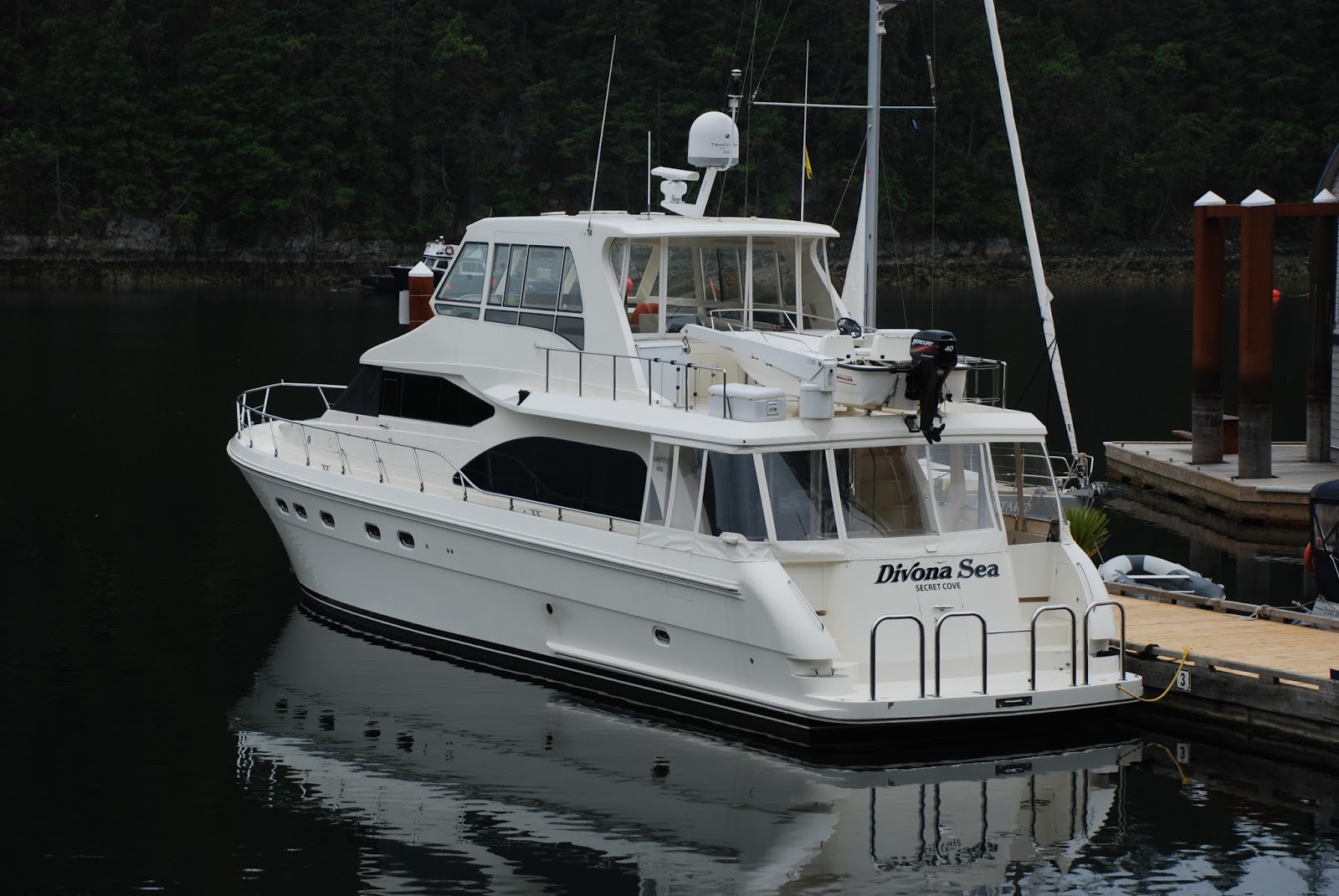
This was our slip at the guest float in the Inner Harbour.
Most of the slips were empty due to the early season.


The Empress Hotel was just up the ramp from where we were moored.  They were working on it while we were there and I could see work men up on the scaffolding very high up on the building.  I guess they had no fear of heights.

We had logged 125 nm to this point.  The leg down to Victoria was somewhat out of the way for a north bound voyage, but we wanted to experience Victoria, so here we were.

The link below takes you to numerous photos of the Inner Harbour (not taken by me).  My photos will be embedded in the post as they always are.

Pictures of Victoria Inner Harbour

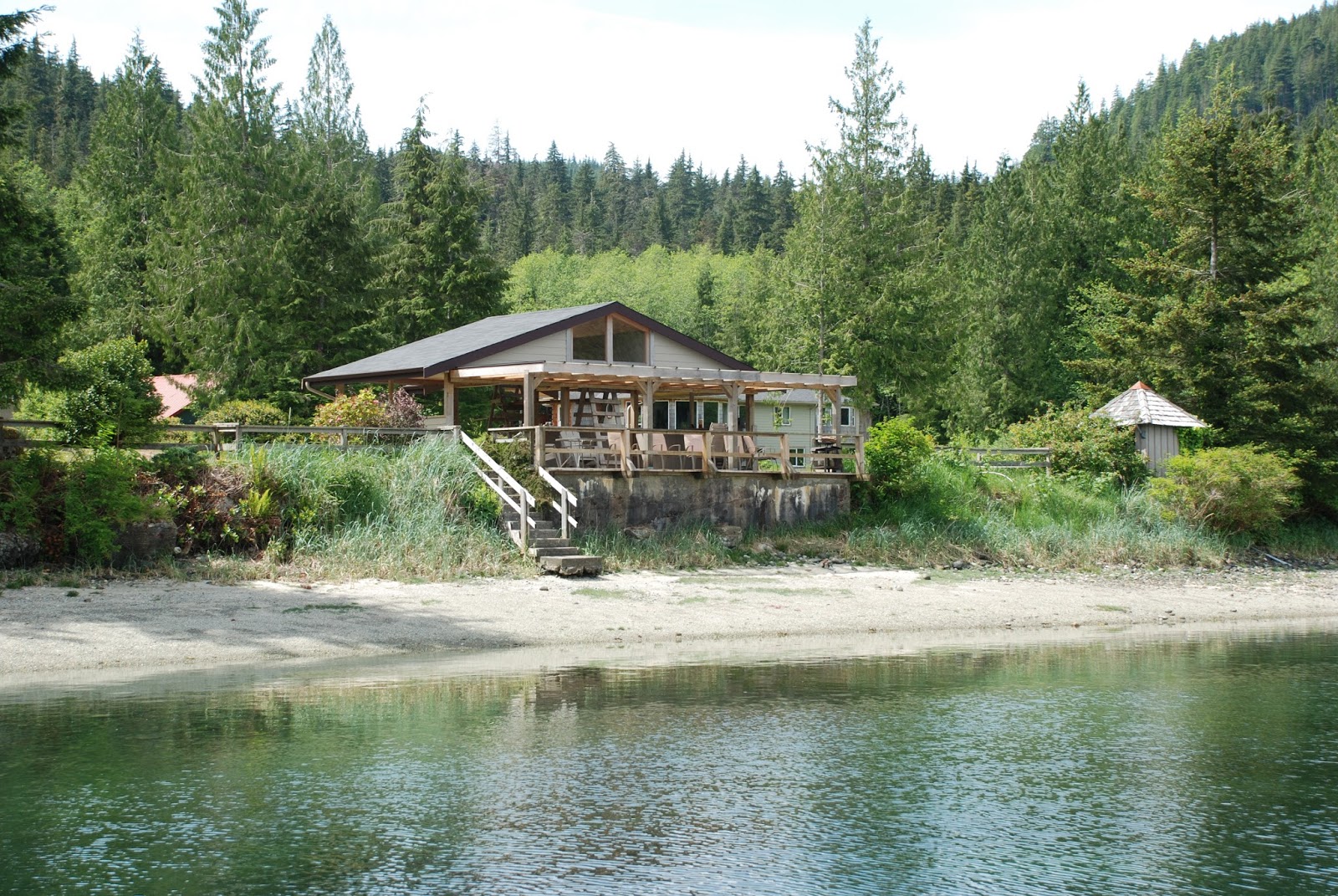
This was a very unique stop for us from a number of different perspectives.  It certainly was not a remote anchorage. While planning the trip I guess I sort of envisioned it being like a marina.  But in fact we were right in the center of downtown Victoria.  I asked the harbour authority lady where the best spots would be to walk a dog and she just made a face.  It's hard to find grass in the middle of downtown, but we did find a few places.

Just up the ramp from the boat there was a promenade of sorts, with booths and carts from local artists and vendors.  There were also some street musicians and performers, although this really wasn't in full swing yet since it was so early in the season.  This place really gets hopping as the season progresses.

I was coming along the promenade very late the evening before our departure and a juggler was practicing.
He said he was scheduled to perform there the next day.
So myself and a couple of others who happened by got a preview of his show.

The Inner Harbour area really lights up at night.
Here are a few of our night shots.
Some are a little blurry, my apologies.


Faraway in her slip at night


On our second day in Victoria we rented a car and drove out to Butchart Gardens.
Here is some information from Wikipedia about the history of the gardens:

Robert Pim Butchart (1856–1943) began manufacturing Portland cement in 1888 near his birthplace of Owen Sound, Ontario, Canada. He and his wife Jennie Butchart (1866–1950) came to the west coast of Canada because of rich limestone deposits necessary for cement production.

In 1904, they established their home near his quarry on Tod Inlet at the base of the Saanich Peninsula on Vancouver Island.

In 1907, 65-year-old garden designer Isaburo Kishida of Yokohama came to Victoria, at the request of his son, to build a tea garden for Esquimalt Gorge Park. This garden was wildly popular and a place to be seen. Several prominent citizens, Jennie Butchart among them, commissioned Japanese gardens from Kishida for their estates. He returned to Japan in 1912.

In 1909, when the limestone quarry was exhausted, Jennie set about turning it into the Sunken Garden, which was completed in 1921. They named their home "Benvenuto" ("welcome" in Italian), and began to receive visitors to their gardens.

In 1926, they replaced their tennis courts with an Italian garden and in 1929 they replaced their kitchen vegetable garden with a large rose garden to the design of Butler Sturtevant of Seattle. Samuel Maclure, who was consultant to the Butchart Gardens, reflected the aesthetic of the English Arts and Crafts Movement.

In 1939, the Butcharts gave the Gardens to their grandson Ian Ross (1918–1997) on his 21st birthday. Ross was involved in the operation and promotion of the gardens until his death 58 years later.

In 1953, miles of underground wiring was laid to provide night illumination, to mark the 50th anniversary of The Gardens. In 1964, the ever-changing Ross Fountain was installed in the lower reservoir to celebrate the 60th anniversary.

In 1994, the Canadian Heraldic Authority granted a coat of arms to the Butchart Gardens. In 2004, two 30-foot (9.1 m) totem poles were installed to mark the 100th anniversary, and The Gardens were designated as a national historic site.

Ownership of The Gardens remains within the Butchart family; the owner and managing director since 2001 is the Butcharts' great-granddaughter Robin-Lee Clarke.

In 1982 the Butchart Gardens was used as the inspiration for the gardens at the Canadian pavilion opened at Epcot Centre in Orlando Florida.

In December, 2009 the Children's Pavilion and the Rose Carousel were opened. The menagerie includes thirty animals ranging from bears, to horses, to ostriches, to zebras and mirrors the world from which The Gardens draws its visitors. The designs were hand picked by the owner, in consultation with an artist from North Carolina. The carvings were done by some of the few remaining carvers of carousel art. Each animal is carved from basswood and took many months to complete. There are also two chariots able to accommodate disabled persons.

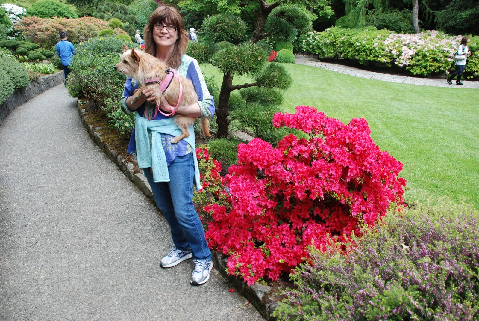
Here are some of our pictures from our day at the Gardens.


I actually had to wait quite a while to get this picture with no one in front of it.  As you can see there are stone benches in front and many groups of visitors stopped there to get pictures of themselves and their groups or families in front of the sign.


The Gardens are dog friendly

Ross Fountain


What you can't see in this shot is that sign in the grass, just behind Lisa.
That's right - it says "Keep Off The Grass."
I guess Bina didn't see it either.
She was hot and wanted to roll in the cool grass.


They have very big squirrels in these parts!


Finally, something I recognize, an Iris.


I have to say that as someone who is not normally impressed by flowers, plants, and landscaping, the Butchart Gardens were indeed awesome.  I really enjoyed walking all amongst the various themed gardens and seeing the wonderful arrays of color.

Since we had a vehicle we took advantage of that and made a road trip of sorts.
We replenished our groceries and other supplies, and then returned the car.
It was just a short walk from the car rental agency to the boat.

We really enjoyed our brief visit to Victoria, but were now ready to begin our voyage north bound in earnest.